Southern California Faults (SCF)
Southern California Faults (SCF) Special Project
This overview map above shows the location of the MASTER flight lines for the Southern California Faults (SCF) project. It links to a larger version of the overview map. Most faults have both daytime and nighttime MASTER data pairs. Daytime flightlines are represented by solid lines, nighttime flightlines by dashed lines; lines are offset from the actual centers of the flight lines for clarity. The HDF files are represented on the map by Flight Line_Flight segment, which correspond to characters 11-20 of the HDF file name. For example, on the map above, 0400612_16 represents the HDF file MASTERL1B_0400612_16_20040826_2220_2226_V01.hdf.
Decorrelation Stretch (DCS) Data
Two decorrelation stretches are provided for each line. DCS743: A decorrelation stretch applied to MASTER bands 47 (um=10.7) 44 (um=9.1) 43 (um=8.6) as RGB. That wavelength combination was chosen to be similiar to TIMS bands 5-3-1(or 2) and ASTER bands 13-12-11. DCSXXX: A second decorrelation stretch is included in which selected bands (um X,X,X) were chosen to maximize scene variation. Note, statistics were calculated for each line independently, therefore similar units in adjacent lines, or the same unit in overlapping lines, may be displayed with slightly different hues. High resolution JPEG versions of the decorrelation stretches are included for browsing. The Algorithm Theoretical Basis Document (ATBD) for the decorrelation stretch algorithm may be found <here>
Temperature and Emissivity (TES) Data
The temperature and emissivity data were calculated for MASTER bands 42-49. TES output is in the format: bands 1-8=emissivity, band9=temperature. The Algorithm Theoretical Basis Document (ATBD) for the TES algorithm.
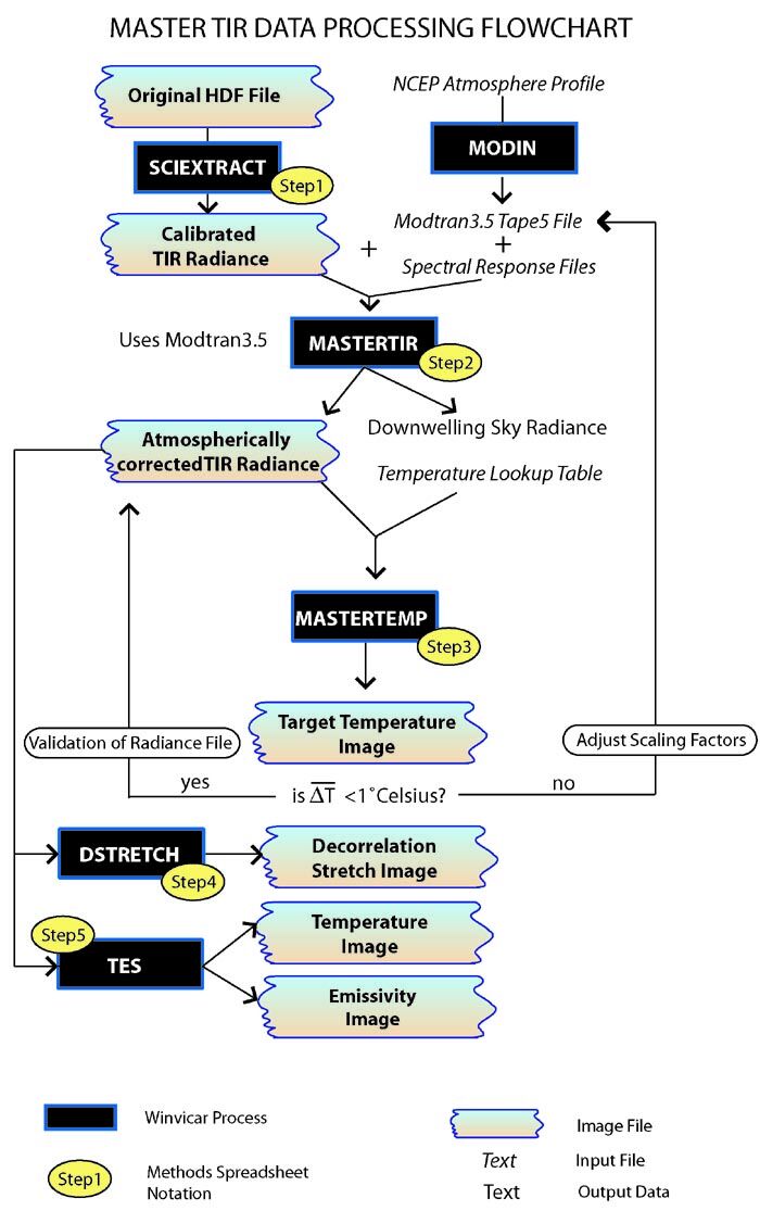
Data Processing
A summary of the data processing flow.
These SCF MASTER higher level data were generated by Janet Harvey.
MAPPING ACTIVE FAULT ZONES IN SOUTHERN CALIFORNIA USING MASTER MULTISPECTRAL IMAGERY DATA. Harvey, J.C., Peltzer G., Hook, S., Myers, J., Dominguez, R., Coffland, B., Fitzgerald, M., and Alley, R., Geological Society of America Abstracts with Programs, Vol. 37, No. 7, p. 559